Sunday, May 09, 2010
Thursday, February 07, 2008
Blackstone Edge - The Long Way
Date of Walk : Saturday 2nd.February
Route : Shaw - Crompton Moor - Rooden Reservoir - Piethorne Reservoir - Windy Hill - Blackstone Edge - Ogden Reservoir - Shaw
Distance : 17.2 miles
It's not often I get out on a Saturday but with the weather, the football was postponed, and the forecast for Sunday was rain. Also, the ground was covered in white stuff so I had to get out. The route started exactly the same as my last walk through the Piethorne valley. However, I ventured off up Windy Hill towards Summit (top of the M62) and then over the top of Blackstone Edge. I only took pictures and videos up to the summit as I was running late due to a lift I had promised my father in law, so the last 4-5 miles were almost at running pace. Well at least quicker than my usual pace anyway.
 Crompton Moor

 The view from the top of Crompton Moor
 Looking down on the village of Denshaw
 The route to Summit. After all the recent rain, the only route without getting your feet soaked was to walk up the banking on the right hand side!
 Looking towards Blackstone Edge
Flickr Album - Blackstone Edge - 2 Feb 2008
YouTube - Blackstone Edge - 2 Feb 2008
Route : Shaw - Crompton Moor - Rooden Reservoir - Piethorne Reservoir - Windy Hill - Blackstone Edge - Ogden Reservoir - Shaw
Distance : 17.2 miles
It's not often I get out on a Saturday but with the weather, the football was postponed, and the forecast for Sunday was rain. Also, the ground was covered in white stuff so I had to get out. The route started exactly the same as my last walk through the Piethorne valley. However, I ventured off up Windy Hill towards Summit (top of the M62) and then over the top of Blackstone Edge. I only took pictures and videos up to the summit as I was running late due to a lift I had promised my father in law, so the last 4-5 miles were almost at running pace. Well at least quicker than my usual pace anyway.
 Crompton Moor
 The view from the top of Crompton Moor
 Looking down on the village of Denshaw
 The route to Summit. After all the recent rain, the only route without getting your feet soaked was to walk up the banking on the right hand side!
 Looking towards Blackstone Edge
Flickr Album - Blackstone Edge - 2 Feb 2008
YouTube - Blackstone Edge - 2 Feb 2008
Sunday, January 20, 2008
Piethorne Valley
Date of Walk : Sunday 20th.January 2008
Route : Shaw - Crompton Moor - Rooden Reservoir - Piethorne Reservoir - Ogden Reservoir - Crompton Moor - Shaw
Distance : 9.2 miles
I had just had enough of this weather and decided I was walking whatever the weather. It was rather murky earlier on but considering the forecast it wasn't a bad day although extremely damp. It's a walk I've done before although never with such rain and damp ground. It also allowed me to continue testing the G9 and I had a couple of attempts at using the video. Hopefully this can become more of a feature especially if we eventually get some better weather.
 Rather murky conditions on the route over Crompton Moor.


This is the footpath!!
Friday, January 04, 2008
Nab Scar - Happy New Camera
Date of Walk : Thursday 3rd January
Route : Rydal - Nab Scar - Heron Crag - Great Rigg - Stone Arthur - Grasmere - Coffin Route - Rydal
Finally managed to get out and give the camera a road test. Set off just before 10 o'clock after parking near Rydal Mount. We headed up to Nab Scar and then continued to Heron Crag and arrived at Great Rigg around lunchtime. We contemplated heading over Fairfield but decided it was rather cloudy and it was extremely cloudy and cold to head any higher with a 9 year old. In fact, it was Beth's decision rather than mine. We then headed back to Grasmere via Stone Arthur and had a wander through Grasmere, which I have never seen so quiet. The walk was completed by heading back along the Coffin Route to Rydal Mount. Unfortunately, very few pictures were taken after Heron Crag. Don't worry the camera's fine, but it started sleeting so I didn't spend all that money to get it wet!! I suppose I'll have to show a bit more bottle in the future!!
 Looking up to Nab Scar
 Looking down on Grasmere and Rydal Water
 Windermere viewed from the path to Nab Scar
 Alcock Tarn
 Zooming in on Easdale Tarn
 Beth's latest idea is to collect an object on each walk! I don't know where she's going to keep them yet.
Flickr Album - Nab Scar - 3 Jan 2008
Sunday, December 30, 2007
Dovestones Reservoir
Date of Walk : Sunday 25th.November
Had actually forgot that I'd not posted these pics, but due to a combination of the horrible weather and a huge flood in my kitchen have been unable to get out recently. It's a bit of a pain as I have a new Canon G9 which needs testing out in the hills. The walk was a 7 mile circular round the lower edges of Greenfield and Dovestones Reservoir.


Had actually forgot that I'd not posted these pics, but due to a combination of the horrible weather and a huge flood in my kitchen have been unable to get out recently. It's a bit of a pain as I have a new Canon G9 which needs testing out in the hills. The walk was a 7 mile circular round the lower edges of Greenfield and Dovestones Reservoir.


Saturday, November 24, 2007
Blackstone Edge
Date of Walk : Sunday 18th November
Route : Ogden Reservoir - Kitcliffe Reservoir - Piethorne Reservoir - Windy Hill - Blackstone Edge - Lydgate - Ogden Reservoir
Distance : 10.4 miles
This was a walk with a new walking group (40s Walkers North) and the weather was pretty dire but the company was great and it was good to put names to faces. We set off from a rather damp Ogden Reservoir with a little excitement as sleet could be seen up on Crompton Moor. What is it that turns perfectly behaved adults into children when there's a bit of white stuff about. The walk continued up the Piethorne valley and then we headed up to Windy Hill. For those unfamiliar with the area it is the top of the M62 at Summit. Then we followed the Pennine Way path over Blackstone Edge. This saw quite a reasonable amount of snow as we gained height. After negotiating Blackstone Edge we came down the Roman Road and then followed the route back to the M62 before heading back down to Ogden Reservoir.
 Ogden Reservoir
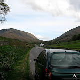
The path on the way up to Windy Hill
 Not quite Striding Edge but it involved a bit of balancing.
 Blackstone Edge
Flickr Album - Blackstone Edge - 18 Nov 2007
 Not quite Striding Edge but it involved a bit of balancing.
 Blackstone Edge
Flickr Album - Blackstone Edge - 18 Nov 2007
Sunday, November 11, 2007
Remembrance Sunday
Date : Sunday 11th November
Distance : 2.5 miles
It's certainly not the achievement of Great Gable and I promise to do that one year, but this is the local service on Pots & Pans which I have walked on plenty of previous outings.
 Looking up Chew Valley.
Distance : 2.5 miles
It's certainly not the achievement of Great Gable and I promise to do that one year, but this is the local service on Pots & Pans which I have walked on plenty of previous outings.
 Looking up Chew Valley.

Haystacks
Date of Walk : Friday 2nd November
Distance : 4.5 miles
Route : Gatesgarth Farm - Warnscale Bottom - Haystacks - Scarth Gap - Gatesgarth Farm
This was the last walk of our short break, and we also took my dad and stepmum along as well. This was a really enjoyable walk although it feels more than 4.5 miles. I would love to repeat it on a day with a little less cloud to get some even better images, but I suppose it is November.


Mellbreak
Date of Walk : Wednesday 31st October
Distance : 6.2 miles
This was an excellent walk with Roger and Ann Hiley (plus Harry and Bethan of course). We met up at their cottage in Loweswater and decided upon heading up Mellbreak and headed for Scale Force before walking back along the shore of Crummock Water. It was great to finally meet up with Roger and Ann who were excellent hosts for the day as well as super company. Beth is also hooked on having a go at completing the Wainwrights but insists we need a dog to do it. I said we'll have to trade her older brother in for a dog!!
 Ann and Beth leading the way (although Harry and Bethan are probably further ahead.)
 Fleetwith Pike
 Two Beths and Harry
 Crummock Water and Buttermere
 Scale Force
 Beth helped Roger tidy up the old gate.
 Beth after a quick shower and change!!
Flickr Album - Mellbreak - 31 Oct 2007
Loweswater Cam - report and photos on our walk
Ashness Bridge
Date of Walk : Tuesday 30th October
Distance : 6.2 miles
Route : Castlerigg Farm - Springs Wood - Keswick (town centre) - Friar's Crag - Calfclose Bay - Ashness Bridge - Great Wood - Castlerigg Farm
This was the start of our short break in the Lakes. The initial plan was to go up Walla Crag, but Beth wanted to pop down into Keswick. We went down to Keswick and walked along the side of Derwent Water and eventually arrived at Ashness Bridge. After leaving Ashness Bridge, the weather appeared to be turning a little grim, so we re-routed through Great Wood. My theory here was that if the heavens opened at least the wood would give us a little shelter. Of course, it never rained but Walla Crag can wait for another day.
 Looking across Derwent Water.
 Friar's Crag
 Looking down Derwent Water towards Castle Crag.
 Ashness Bridge
The view towards Bassenthwaite Lake.
Flickr Album - Ashness Bridge - 30 Oct 2007
Flickr Album - Ashness Bridge - 30 Oct 2007
Subscribe to:
Posts (Atom)
