Friday, May 11, 2007

Reservoir Round

Date of Walk : Monday 7th May

Distance : 11.2 miles

Route : Blackstone Edge Reservoir - Light Hazzles Reservoir - Warland Reservoir - Gaddings Dam - White Holme Reservoir - Blackstone Edge Reservoir


This was another road test for my new boots but I set off with the intention of doing about 7-8 miles. You know what it's like when you think just a bit further and pop along the next ridge and so on. Sadly I paid for it later as I had a few blisters but it won't stop me getting out this weekend, although the weather might.


The start of the walk with Hollingworth Lake visible in the distance.


Blackstone Edge Reservoir


Chelburn Reservoir (I didn't walk round this one!)

Light Hazzles Reservoir


Warland Reservoir


Flickr Album - Reservoir Round - 7 May 2007

Saturday, May 05, 2007

These Boots Are Made For Walking

Date of Walk : Sunday 29th April

Distance : 6.2 miles

Route : Shaw - Crompton Moor - Ogden - Shaw


This walk was nothing special and it was a spur of the moment walk at about 4.30 on a Sunday afternoon. I had some new boots so wanted a reasonable walk but not too far as new boots can cause problems so I wanted a ramble of about a couple of hours to test them out.


Looking back into Shaw (my home) on the way up Crompton Moor.


The view from higher up on Crompton Moor.


Piethorne Reservoir

Looking up towards Bleakedgate Moor


Flickr Album - Crompton Moor - 29 April 2007

Sunday, April 22, 2007

Easter Week - The Lakes

I wanted to hit the Lakes for Easter weekend but as my football allegiance was taking me to Kendal on Easter Monday, I decided to continue after the football and spend the week on the Solway. (My dad has a house about 5 miles outside Maryport which makes a good base.)

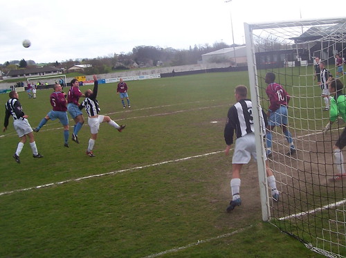
Action from the Kendal Town v Mossley game on Easter Monday

Date of walk : Wednesday 11th.April

Distance : 4.9 miles

Route : Stonethwaite - Rosthwaite - Watendlath Tarn - Dock Tarn - Stonethwaite


Yet another fine example of dry stone walling.
Looking back towards Stonethwaite.

Beth nearly manages a smile!


Watendlath Tarn

Looking back to Watendlath Tarn on the path towards Dock Tarn.


Views across the Borrowdale Valley. (I think)
Dock Tarn


Date of Walk : Thursday 12th April

Distance : 4.4 miles

Route : Mawbray Bank - Mawbray Hayrigg - Newtown - Mawbray Bank


Just a short stroll along the side of the beach today aiming to reach a rather nice cafe at Mawbray Hayrigg. Unfortunately, it was such a nice day that half of the Solway seemed to have the same idea!


The beach at Mawbray Bank.

Looking across to Scotland.


Date of Walk : Friday 13th April

Distance : 3.9 miles

Route : Pooley Bridge - Howtown Pier - Pooley Bridge (via ferry)


Looking across Ullswater.


Beth looks a little happier this time.


Looking up towards Barton Fell.

Looking down Ullswater.


Flickr Albums - Kendal Town v Mossley - 9 April

Watendlath & Dock Tarn - 11 April

Ullswater - 13 April

Saturday, April 07, 2007

Blast From The Past

Pots & Pans

Date of walk : Thursday 5th April

Distance : 5.7 miles


Many people have given me advice regarding my ankle while I have been unfit to walk but I decided to take the plunge and invest in some walking poles to see if they will help me. I am still unsure even after this walk but I'm not getting any younger as Beth keeps reminding me. I decided to walk along the old railway through the Saddleworth villages of Greenfield and Uppermill for those familiar with the area. This where I spent my youth so it was interesting to walk past one of my old houses and both my schools. Very few people are left in these villages from when I lived here due to the astronomical house prices. I then cut through the fields leading to Saddleworth Church and I think it was in these fields that I embarked on my first camping trip. After arriving at the church and spending time studying graves (I don't know why!!) I then took the plunge and hit the hills so to speak.


Having been unable to walk on rough ground for the best part of two months made this quite a momentous occasion. I walked up onto the ridge and headed towards Dick Hill and then to the War Memorial and I couldn't belive quite how warm it was when one considers the height I was now walking at.

After leaving the memorial I headed to the top of Alderman's Hill where on a day like this the views are pretty spectacular. Not quite the Lakes but I think a pretty close second. People unfamilar with this area will wonder why it's called Pots & Pans as there is no mention of this on a map. Some local historian will probably prove me wrong but some locals felt the stones looked like kitchen utensils!


Road to Recovery Continues

Hollingworth Lake

Date of walk : Monday 2nd April

Distance : 2.4 miles


Not a lot can be said about this walk as once again apart from giving my foot further exercise it is pretty frustrating to be walking round reservoirs when I want to be much higher. It could be worse as I suppose it could be raining.


Almost back

Dovestones Reservoir

Date of walk : Saturday 31st.March

Distance : 3.1 miles


The ankle injury was much worse than I had anticipated and it has been extremely frustrating. It annoyed me so much that I didn't bother writing in my blog. I went to the Lakes mid February as I had promised Beth but it was pretty scary as the minute I left the firm ground on the road it just felt like my ankle was going to give way.


This made me decide to have the ankle checked again and what I hadn't realised at the time was that as well as damaging my ankle I had caused considerable damage to my achilles tendon. I decided to give it healing time and and once I was moving reasonably well (early March) I put myself on a regime of walks involving footpaths and roads and sadly where I live this didn't involve anything worth blogging or photographing.


The ankle isn't perfect yet but I will have to take my time. Anyway, I decided to use the lower level at Dovestones Reservoir to see how the ankle was feeling. It's not the most exciting walk in the world but the scenery isn't too bad. In fact, Beth refused to come with me as she said it was a boring walk and she would only come once we could go back in the hills. Kids!!


Thursday, February 08, 2007

Ouch that hurts!!

Wessenden Moor

Date of walk : Sunday 4th.February

Distance : 7 miles


At last a wind free day in this neck of the woods and the sun was shining, so what could go wrong I thought. Why?? I set off across a fairly treacherous route heading to pick up the Pennine Way. This meant a trek of about a couple of miles across some pretty slippery mounds but I thought my previously problematic left ankle could cause problems so I decided caution was necessary and to take my time. I was within about half a mile of picking up the Pennine Way when disaster struck but not my left ankle but the other one. I slipped and the ground gave way as this time my RIGHT ankle twisted but the pain that ensued at first made me wonder if I had broken it. Anyway I decided I was going to get back to the car somehow but I didn't think the treacherous route I had just covered was the best route so decided to head for the Pennine Way and complete the walk I had planned. This would mean a walk of about 4-5 miles on a knackered ankle but I thought that was better than slipping again and breaking it. Was I wise? Who knows. All in all it was still a pleasant walk but the last couple of miles did result in rather a lot of pain. I finally got back to the car and once I got my boots off the ankle seemed to swell a little but I decided to drive home and have a bath and stick some ice on it. However, when I got my socks off the ankle looked so swollen that I decided to brave the local A&E. Luckily it was only a very bad twist but I have decided I need to give it time for a rest but hopefully I will be back on the peaks in about a month. The shame is I was heading for the Lakes next week. I will still go as I had promised Beth but I'm afraid there will be no peak bagging.

The reservoir in the distance marks where I will pick the Pennine Way up.

Wessenden Reservoir in the distance.

The river near Blakeley Reservoir.

Wessenden Reservoir


I had to slide down this hill on my backside due to my ankle injury!

Wessenden Head Reservoir & Wessenden Reservoir (in the distance)

The route with the red flag for the ankle injury!!

Flickr Album - Wessenden Moor - Feb 2007


Blog Counter